
We have been discussing with a colleague how it would be possible to automatically detect all potholes in large road networks. Last week at the INTERGEO exhibition, I discovered three companies which offer this service. In this market survey, I summarise what I found out about them. I returned last week from the 25th INTERGEOContinue reading “Asset management, but not the kind you think”
Tag Archives: GIS
Santa’s Christmas delivery route revealed
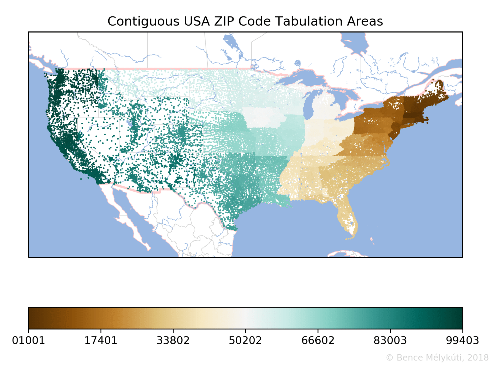
Data visualisation meets children’s curiosity. We immerse ourselves in geoinformatics to find out how postal services in the USA, in Germany and in Hungary carved their countries into mosaics of postal code areas. Visually striking maps emerge from the opaque depths of numerical data. Whoever still sends letters by post will notice that addresses closestContinue reading “Santa’s Christmas delivery route revealed”
